
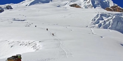
Mera Peak Expedition via Phaplu is the most reliable and adventurous trek that leads to the summit of Mera Peak through different routes starting from Phaplu, a lower part of the Solu Khumbu region. This route from Phaplu will allow you to skip the Lukla or any other mountain flight. So, there is no risk of flight cancellation or delay. Also, the trek starts from lower altitudes at Khari Khola after driving to Phaplu. So, it also allows for better acclimatization to altitude up to the highlands.In this 19-day itinerary, you’ll follow the long trail to the peak (6,461m), one of the 600 There are a couple of routes to visit Mera Peak. The usual route starts with Lukla and passes through several settlements like Chutanga and Thuli Kharka; then, crossing Zatrwa La Pass (4,600 m), you’ll join the Kothe.However, the route to Mera Peak Expedition via Phaplu begins from Khari Khola and passes through Panggom, Ramailo Danda, and Chattra Khola to reach Kothe. Starting a trek from a lower land such as Phaplu, Mera Peak Climbing via Phaplu offers you enough time to acclimatize adequately before scaling the summit. This route will not only help you acclimatize better, but the trail from Phaplu provides beautiful scenery and is much quieter than the trail starting from Lukla.From Kothe, you’ll follow the standard route to Thaknak and Khare. At Khare, you’ll get pre-climbing training which will help you to ascend the summit more confidently. After that, you’ll hike to Mera Base Camp and Mera High Camp. Afterward, you’ll climb the Mera peak and retrace on the same trail till you reach Kothe. En route undoubtedly, you’ll enjoy the outstanding views of the Everest region.From the top of the peak, you’ll get the best mountain scenery with five eight-thousands, including Mt. Everest (8,848m), Lhotse (8,516m), Makalu (8,485m), and Cho Oyu (8,201m), as well as other Himalayan peaks. After summiting, you’ll have a relaxing trek to Thamdanda from where you will drive back to Khari Khola and then Kathmandu. So, while returning to Kathmandu, you’ll take an overland tour instead of taking a flight. So, while returning also there will be no headache of flight irregularities. With the final departure flight, your Mera Peak Expedition via Phaplu ends.
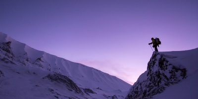
Pokhalde Peak is simple and easy trekking peak for climbing which elevates to the North of the Kongma La above the Khumbu glacier, opposite of Lobuche with relatively low altitude. This peak offers interesting and adventurous trekking experiences to the climbers. From the summit of the peak, one can outlook the panoramic views of mountains which definitely gives a unique experience. The peak is approachable via two routes: Bibre / Chhukung and Dughla. The routes have several modes to move toward this peak. In Dughla route, there are several ways like North Ridge, North East Face, North West Face, North West Face and South Face. For Bibre route, trails follows Everest trekking trail upto Tsuro Og and Yarsa trek.First ascended in 1953, Pokalde Ascent fulfills your amateur mountaineering desires, taking you above the normal experience of mountain treks and below the technically equipped, skill-and-effort demanding climbing expeditions. The high camp for the peak is established at the valley below the Kongma La Pass (5,535m), which has a turquoise glacial lake in the middle. For the final ascent, you can reach the pass and follow the ridge (the route of the first ascent). Amazing View such as Mt. Makalau, Lhotse, Nuptse, Pumo Ri, Ama Dablam and so on. Amazing Nepal Journey is organizing to make successful climb to Pokhalde Peak and Khoma La Trekking since a long time .
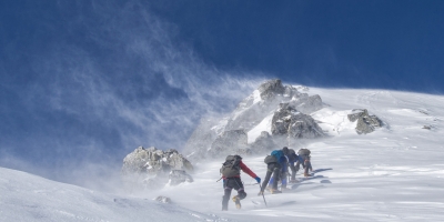
Dhambus Peak is situated in the Dhaualagiri region the northern side of the wildest valley of Nepal (hidden valley) and along with Kaligandaki River flow its bottom. It is an interesting peak for climbers in the North-East of the big Dhaulagiri massif. It is an easy trekking peak to ascent for climbers. The overwhelming altitude differences between the Annapurna and Dhaulagiri ranges make Dhampus Peak a very exposed spot to observe the scenery from. Having Tukuche Peak (6920m) and Dhaulagiri (8167m) spectacularly near you enjoy the feeling of being part of the extreme altitudes of the Himalayas. This peak provides you more than thirty mountains views like Dhaulagiri I (8163m), Sita Chuchura (6611m), Nilgiri (6940m), Tukche Peak (6920m), Tilicho peak (7134m), Thorong Peak (6484m), Yakawa Kan (6482m), Puth Hiunchuli (7246m), Mukut Himal (6639m), Tangu Peak (6197m), Hongde peak (6556m), Tsarste (6347m) and more snow capped mountains and as well as Dhaulagiri glacier and deepest gorge of the world. Amaing Landscap view appearing from the top Mistang region and Dolpo region too. Amazing Nepal Journey is every season organizing the successful trip in Nepal.
Larke Peak (6010 m/19,713ft) is very nice and a newly opened peak climbing lies in the Manaslu region of Gorkha, Nepal. Gorkha is a small independent state from where the unification of modern Nepal began, also it is the starting point of the trek. In 1992, Manaslu region has been opened to western visitors there; which offer an unsurpassed beauty, a combination of rich culture heritage, and biological diversity. Larke peak lies in mid-northern Tibet Border of Nepal are a challenging alpine experience in the Himalayas. The Larke peak has been issued to climb since 2002 and you need a special permit for Larke Peak Climbing and Manasalu Trekking, and to enter the mythical universe of living Tibetan traditions.Manaslu means “The spirit-mountain” in the regional language, referring to the benevolent and strong deity, which dwells within. Trekking to Manaslu and Larkya peak climbing is one of the most delightful adventures. The trek drive to Soltikhola by Jeep from Kathmandu follows from Budi Gandaki River valley and ending in Dharpani then drive to Beshisahar - Kathmandu. During the trip so many diversity of culture such as Gurung, Magar, and Tibetan Buddhist culture follow up to Samdo, the last settlement before Larke Peak and Larke La pass. Larke peak is pretty tricky and hard to find a top to bottom hence the climber requires a knowledgeable guide. The routes consist magnificent panoramic view-points to admire the lofty mountain summits like Langtang, Ganesh Himal, Buddha Himal, Annapurna and Siring etc. The trail continues northward passing through many villages of the Tibetan origin. These villages offer an opportunity to explore their customs and cultures, Monasteries prayer flags, a Prayer wheel, and Prayer walls. Amazing Nepal Journey is operating the Larke Peak Expedition since a long time with 95% successfully.After Larke peak climbing the trekking route goes through Manaslu and joint famous Annapurna circuit area. If you want to continue the trek you can also continue your trek to the famous trek of Annapurna Circuit Treks in Nepal. Then you trek down to Bimthang, then ending the treks in Dharapani then takes jeep to Besisahar. Finally, you can drive a local bus or private vehicle to Kathmandu.
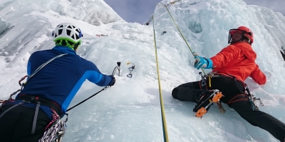
Parchamo Peak (6273m) lies south of the Tesi Lapcha Pass and, when seen from the pass, the mountain is really attractive. It is a straightforward snow peak first climbed in 1955. The Rolwaling Valley is the main access to Parchamo even though from Khumbu valley also possible it. Tashi Lapcha Pass Trek and Parchamo Expedition begins with a drive to Gonggar/ Chhetchhet via Charikot from Kathmandu where we pass villages such as Simigaon, Bedding, and Na Gaon with an amazing view of Mount Gaurishankar( Holy Mountain) (7134m). In Na Gaon, we explore the Yalung Glacier and climb on the training peak Yalung Ri(5630m). Leaving Na Gaon, we climb uphill to Tsho Rolpa Lake (4540m), the largest glacial Lake in Himalaya. Then, waking on Trakarding Glaciers, the trail reaches Tashi Lapcha Pass (5755m), which separates the Rolwaling region from the Khumbu region and the Gaurishankar Conservation Area from the Sagarmatha National Park. Parchamo climbing rout is from the North side of the peak and it's not very technical climbing peak but its very deep snow and wind makes difficult climb and we follow the ridge crevasses near by the summit. The panoramic views are so beautiful appearing from the summit.After the Summit to Parchamo the trail joins the trekking trails of the Everest Region which is ever bustling with tourists from inside and outside the country. the trail heads down to the bustling Sherpa town of Namche Bazaar via Thame and leads to Lukla, from where a flight back to Kathmandu is taken. Rolwaling -Tashi Lapcha Pass - Parchamo Peak Climb is an amazing opportunity to observe the different facets of the Himalayan lifestyle as it goes from a remote to a rather urban route of the Himalayas with Amazing Nepal Journey.
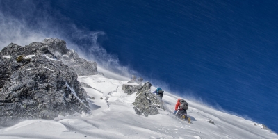
Tent peak (Tharpu Chuli ) is easy peak climbing trip in Annapurna region. Tent peak climbing is known as Tharpu chuli peak climbing located near by Annapurna base camp . Tent peak 5695m climbing offer trekking in Annapurna base camp and best Himalayan views of Annapurna region including Annapurna I, Annapurna South, Annapurna III, Machhapuchhare (Fish tail), Hiunchuli, Singu Chuli and Gangapurna. Tharpu chuli peak climbing take to you heart of the Annapurna trekking trail . Tent peak climbing required good physical fitness and required minimum two weeks holidays.Tharpu chuli peak climbing begins from Phedi after one hour drive from Pokhara. Amazing Nepal Journey Treks’s climbing guide led through Dhampus Deuarali Tolkha Jhinudanda Chomorung Dovan bamboo Machhapuchhare base camp and finally reach at Annapurna base camp (4130m). From Annapurna base camp trail then cross the glacier then continue ascend till Tent peak base camp and next day High camp put the tent then next early morning our climbing guide take to you Tharpu chuli peak summit( 5695m). The climbing rout easy rocky part in the begging, then gently ascent the last part is really vertical with fix rope . Appearing excellent views of whole Annapurna region from Tent peak summit then trail descend till Chmorung village. The you have three alternative way descent to Pokhara via Gandruk, Ghorepani and via Landruk by Jeep drive to Pokhara directly .

Mt. Makalu(8463 M) is the fourth tallest in Nepal and fifth highest Peak in the World. Mt. Makalu resides in the eastern Himalayas range just 20Km southeast of the giant Mt. Everest in the border of Nepal and China.Mt. Makalu expedition is one of the best and really remote with Ultimately Adventure who loves mountains. Amazingly climb to Makalu with full of joy. It was in 1955, when the expedition led by French team reached to the top of Mt. Makalu for the first time. Only five of the first sixteen attempts were successful. Makalu bears a pyramid shape. South East and the North West Ridges being the most prominent compared to other. The base camp is normally set at around 5,600m, and then four camps follow before reaching the top. The first camp is at 6,100m, camp 2 is at 6800m, the third camp is at 7200m and the last camp is at 7600m- 7900m.The South East Ridge and the Northwest Ridge are the main climbing routes on Mt. Makalu. The 8485m peak usually takes around 48 days to climb. Most climbers are able to climb Makalu in both the spring and autumn seasons. It is located at the coordinates of 27°53'21'' N and 87°05'27'' E. The approach to Makalu is beautiful and elegant, the Barun Valley provides stunning contrasts where high waterfalls cascade into deep gorges, craggy rocks rise from lush green forests, and colorful flowers bloom beneath white snow peaks. Within this wide range of altitudes and climates, the Makalu-Barun area contains some of the richest and most diverse flora and fauna of Nepal. Diverse ethnic communities of Rai and Sherpa have inhibited in the valley.The climbing itself is appropriate for both the experienced climber and the novice climber making their first 8,000 meter peak ascent. The climbing consists of easy glaciers low on the mountain, steep ice and snow climbing to the Makalu La and above Camp IV a final rock ridge to the summit. Makalu is a steep and consistent climb, and in the spring season has excellent snow coverage and low hazards like icefalls, rock falling and avalanche. Amazing Nepal Journey Treks and Expedition utilizes oxygen above 7,000 meters and climbing guide support with fixed ropes throughout the climb route and set up the tent etc.Makalu Advanced Base Camp (5600M):Makalu Advanced base camp is located on a rocky moraine with amazing views of the Himalaya. Expedition climbers spend most of their time at base camp, so naturally on any long expedition, base camp becomes a home away from home. We establish our camp at a walking distance between different groups and with a strategic view of the Makalu massif. Amazing Nepal Journey Treks & Expedition provides a personal tent which becomes your private retreat, a dining tent that is sharing in the group, a shower tent and toilet tent too. When you arrive at base camp it will already be fully established with hot beverages and snacks available immediately. Waiting for you there will be your base camp staff and high altitude climbing Sherpa. Prior to your climbing period you will have a Puja ceremony at the base camp for good luck and safe climbing passage for everyone involved in the expedition.Makalu Camp 1 (6,100m),4hrs:Once you have reviewed basic and advanced training by your climbing guide, you will be ready for your attempt to climb to camp I which is at a height of 6200m. In the first section of glacier you will encounter rock slabs and moraine. Once on the glacier you will be on mixed terrain and crevasses with blue ice. The first section of climbing on the moraine takes about an hour after that you reach the crampon point at the mouth of the glacier. For average climbers it takes about 3-4 hours. Camp I is divided into two sections, lower camp I and upper camp I. So camp 1 is fixed between 6100-6400m.Makalu Camp 2 (6800m) 3hrs:The climbing from camp I to camp II is considered the moderate technical section on Mt. Makalu. This section is ice and snow part. The first section is slogging over snow for around an hour, and then you encounter several steep sections of ice, there are small sections of ice fall. These sections can be crossed with the support of fixed ropes, a few big steps and some steep snow climbing. Camp 2 is situated above the snowy terrace wit Amazing views.Makalu Camp 3 (7200m) 4-5hrs:The distance from camp II to camp III is the longest part of the route, it extends arount 600m. It does not require any ladder crossings, but there are a few crevasses that are roughly a half meter long that need to be jumped. The main ropes are fixed by a climbing Guide. This section for most climbers feels easier, but still it is not to be taken lightly. The climbing is on sustained slopes and there is exposure to cold and wind. From the III camp 40% of climbers plan to do their summit to Mt. Makalu. However, Amazing Nepal Journey always fixes camp IV before the summit so that climber can get chance a half nights rest. This section takes about 4 hours for normal climbers and 5 hours for slower.Makalu Camp 4 (7900m):Climbing from camp III to camp IV looks like a short day, however feels so difficult due to altitude . The oxygen levels are very low at this altitude so it is expected that.. In this part you have to climb for 3 hours on steep snow that is on a 50º-55º slope. This section is little dangerous in the autumn season because the snow slope is covering a layer of ice which make the section avalanche prone. Amazing Nepal Journey make easier and day for Summit.Makalu Summit day (8485m)-15 hrs: This day is very important for main goal to summit the peak. If all goes well they reach the summit between 8-10am. Below the main summit is a false summit, the main summit is reached via an exposed ridge. It takes about 5 hours to return to Camp 4 from the summit and another 2 hours to get to camp three for overnight stay. The climbing is not technical in the early part as you ascend through several basins with short snow headwalls. The climb passes the false summit and finishes on an exposed ridge to the true summit for a spectacular view of the Amazing Mountains view. Amazing Nepal Journey' Guide will make fix ropes, break trail and make every effort to assist the group to reach the summit of the 5th highest mountain in the world.
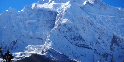
Pisang Peakis located in the northern part of Nepal. It lies in between Annapurna I and Manaslu. Pisang Peak (6091m) is the most popular climbing Peak among the trekking peaks in Annapurna region as it is famous for the easy climbing peak. Pisang Peak rises from yak pastures above the village of Pisang in a uniform slope to the final summit pyramid which is an undistinguished snow and ice slope. In 1955, a German expedition was made the first ascent of Pisang peak and since it has been going very popular nowadays. Pisang Peak climbing route from Pisang village heading up directly Pisang peak base camp, High Camp and Summit.The first part of the Pisang peak meadow up hill until camp 1 , from high camp really rock climb, then ice and snow last part, the middle part is quite rick due to rock fall so always full climbing equipment set require for safety. Real summit of the peak is follow the ridge with snow and ice with rope. The view is so amazing from the top , appearing whole rang of the Annapurna, Tilicho, Himlung, Manasalu, Kangaru, Churen , Himlung Himal, Upper Mustang and the dolo region as well. Pisang peak provides its climbers an interesting journey passing along varied ecosystems, diverse cultures, a reasonably high level of physical fitness and health is still strongly recommended. Amazing Nepal Journey Treks & Expedition is organizing such beautiful adventure trip in Nepal since two decades up to now with 100% achievement with fully satisfaction of the all clients.
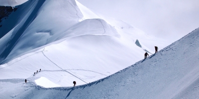
Chulu East Peak(6584m)is very famous trekking climbing peak in Annapurna region and situated in a small valley and lay north of Manang. In fact, there are three Chulu Peaks- East , West and east far . Among them,Chulu East Peak Climbing (6584m) is more elevated one. The Chulu East Peak is an exciting peak mountaineering option for those trekkers who would love to go to experience adventure in the Annapurna Region. While mountaineering the peak, we will be rewarded by splendid views of peaks like Dhaulagiri, Annapurna, Nilgiri, Manasalu, Gangapurna, Thorong Peak and other massive peaks. Also, climbing the Chulu East Peak requires a good physical condition and a high level of energy. Chulu East peak is one of the parts of the Manang Himal, which is quite specifically included in the bigger Damodar Himal. In the north-to-south way we can observe the pouring of rivers- Nar Khola and Phu Khola. To the south the track is bordered by the Marsyangdi Khola and the Mesokanta La.Chulu Far East (6059m.) tour begins from Beshi Sahar before after driving for 5-6 hours from Kathmandu and from Beshi Sahar the way goes up slowly to Manang valley, one of the highest valleys in the world located at an elevation of 5000m.However, now you have deferent option to reach Chulu due the road until Manang (3351m),Amazing Nepal Journey Treks & Expedition recommend Drive to Chame from Kathmandu by Jeep then the trail from Pisang via Ghyaru, Nagawal all the way through the path until we enter Yak Kharka (4000m.). From here the track is vertical up to the base camp of Chulu East. And then we follow the route climbing to the summit of Chulu East which is intresting, icy and very much vertical. From the top of Chulu East we will witness the enormous views of Annapurna I, II, III, IV, Manaslu, Gangapurna, Chulu West, Pisang Peak, the north part of Himlung Valley. exploring Gyaru and Pisang village and visiting Muktinath temple. Go for climbing the Chulu peak taking support from Amazing Nepal Journey make a daydream of peak climbing experience at the regions of Annapurna come true. Spring and autumn are perfect seasons to go for climbing Chulu East Peak.
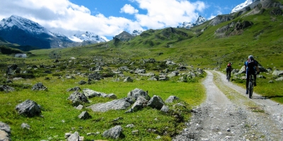
Dolpa is situated in the Trans-Himalayan region of north-west Nepal. Dolpa is also spelt as Dolpo and remains as an isolated and one of the remotest areas of Nepal which has a great biodiversity and cultural richness in Nepal. The Dolpo to Jomsom off-the-beaten trek is designed for the trekkers who prefer to accept more challenging trail that involves many high passes and is possible to do only in certain time of the year. Upper Dolpo is part of the Tibetan Plateau and culturally rich with Bön villages and GOMPA or monasteries. “BON” is the main and old Tibetan religion that pre-dates Tibetan Buddhism. SheyGompa is one of the most important spiritual sites on the way to Upper Dolpo to be visited. This trek will require a reasonable fitness and some previous trekking experience in the Himalayas. Upper Dolpo is good walking country however there are several steeper trails with exposure such as around SheyPhoksundo Lake. Although there are no technical passes on this trek, some toughest passes are recorded so far. The major attractions of Dolpo region is the wild and pristine landscape which is unlike to most other parts of the Nepal Himalayas having the fascinating villages, scenery and peace that offers opportunities to visit ancient villages, high passes, beautiful lake and isolated Buddhist monasteries. A great Tibetan influence can be experienced here and the villagers of Tibetan stock are skilled traders taking their yak caravans between Tibet and Nepal in Autuman season yet.One of the highest inhabited realms on the planet, Dolpo is also still a stronghold of the pre-Buddhist, shamanistic Bon-po religion as well as Tibetan Buddhism. It is a tough, mountainous region of fortified villages, 'dzongs', turquoise lakes, sacred mountains and high passes, susceptible to heavy snows which isolate it from the rest of Nepal.Mustang is one of the best landscape in Nepal , it is sister o of the Upper Dolpo however Mustang is more modernization then Upper Dolpo. Therefor e , Upper Dolpo is still more traditional way of live, culture , religion practice etc. We will not enter really Upper Mustang part however we can see all Upper Mustang landscape during the trip. After SangdaBhanjyang we have enter the Mustang part within Jomsom it is Lower Mustang.Our trek begins with a spectacular flight along the Himalayan range to Juphal. We head up the Suligad River gorge to Phoksumdo Lake and cross our first 5000 meter pass leading to sacred SheyGompa and the 'Crystal Mountain'.. The trails connecting these remote villages and high passes are some of the most culturally interesting and spectacular routes in Dolpo, and the inhabitants still trade with Tibet along the old salt routes.Amazing Nepal Journey Treks & Expedition is organizing such beautiful adventure trip in Nepal since a long time up to now with 100% achievement with fully satisfaction of the all clients.
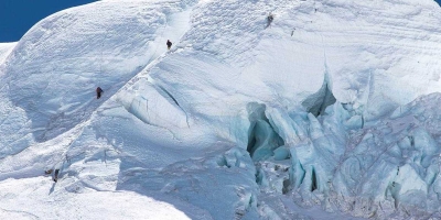
Chulu Far East (6059m.) Peak is very famous trekking climbing peak in Annapurna region and situated in a small valley and lay north of Manang. In fact, there are three Chulu Peaks- East , West and east far . Among them, Chulu West (6419m.) is more elevated one. The Chulu West Peak is an exciting peak mountaineering option for those trekkers who would love to go to experience adventure in the Annapurna Region. While mountaineering the peak, we will be rewarded by splendid views of peaks like Dhaulagiri, Annapurna, Nilgiri, Manasalu, Gangapurna, Thorong Peak and other massive peaks. Also, climbing the Chulu West Peak requires a good physical condition and a high level of energy. Chulu West peak is one of the parts of the Manang Himal, which is quite specifically included in the bigger Damodar Himal. In the north-to-south way we can observe the pouring of rivers- Nar Khola and Phu Khola. To the south the track is bordered by the Marsyangdi Khola and the Mesokanta La.Chulu Far East (6059m.) tour begins from Beshi Sahar before after driving for 5-6 hours from Kathmandu and from Beshi Sahar the way goes up slowly to Manang valley, one of the highest valleys in the world located at an elevation of 5000m.However, now you have deferent option to reach Chulu due the road until Manang (3351m),Amazing Nepal Journey Treks & Expedition recommend the trail from Pisang via Ghyaru, Nagawal all the way through the path until we enter Yak Kharka (4000m.). From here the track is vertical up to the base camp of Chulu East. And then we follow the route climbing to the summit of Chulu Far East which is pebbly, icy and very much vertical. From the top of Chulu Far East we will witness the enormous views of Annapurna I, II, III, IV, Manaslu, Gangapurna, Chulu West, Pisang Peak, the north part of Himlung Valley. exploring Gyaru and Pisang village and visiting Muktinath temple. Go for climbing the Chulu peak taking support from Amazing Nepal Journey make a daydream of peak climbing experience at the regions of Annapurna come true. Spring and autumn are perfect seasons to go for climbing Chulu West Peak.
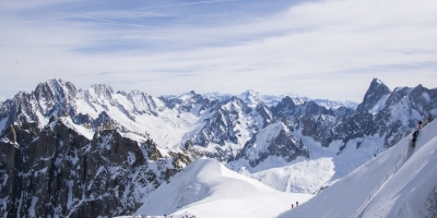
Chulu West Peak is very famous trekking climbing peak in Annapurna region and situated in a small valley and lay north of Manang. In fact, there are three Chulu Peaks- East , West and east far . Among them, Chulu West (6419m.) is more elevated one. The Chulu West Peak is an exciting peak mountaineering option for those trekkers who would love to go to experience adventure in the Annapurna Region. While mountaineering the peak, we will be rewarded by splendid views of peaks like Dhaulagiri, Annapurna, Nilgiri, Manasalu, Gangapurna, Thorong Peak and other massive peaks. Also, climbing the Chulu West Peak requires a good physical condition and a high level of energy. Chulu West peak is one of the parts of the Manang Himal, which is quite specifically included in the bigger Damodar Himal. In the north-to-south way we can observe the pouring of rivers- Nar Khola and Phu Khola. To the south the track is bordered by the Marsyangdi Khola and the Mesokanta La.Chulu west peak tour begins from Beshi Sahar before after driving for 5-6 hours from Kathmandu and from Beshi Sahar the way goes up slowly to Manang valley, one of the highest valleys in the world located at an elevation of 5000m. However now you deferent option to reach Chulu due the road until Manang (3351m) ,from Manang valley the path moves north to the Chulu West Base camp very few days so not enough acclimatization .Amazing Nepal Journey Treks & Expedition recommend the start the trekking from Chame (2713m) , from Kathmandu to Chame drive by Jeep then to start waking for the trip. The major highlights of the trek are passing through the Marsyangdi valley which will mesmerize you with the views of Manaslu, Gangapurna, Annapurna II, III, IV and Tilicho peak; exploring Gyaru and Pisang village and visiting Muktinath temple. Go for climbing the Chulu West Peak (6419m.) taking support from Amazing Nepal Journey make a daydream of peak climbing experience at the regions of Annapurna come true. Spring and autumn are perfect seasons to go for climbing Chulu West Peak.

Baruntse Expedition (7129m/23,389ft) is located in the heart of the Himalaya, the Khumbu. It is in very close vicinity to Mount Everest and Mount Makalu.It is located away from the standard trekking paths so climbers can experience a sense of being in a remote area without investing considerable amount of time and effort. The Baruntse expedition becomes increasingly popular with climbers wishing to escape from the peak climbing on the overcrowded Ama Dablam and Himlung . Baruntse expedition is a month long adventure and an extraordinarily aesthetic objective for peak climbing in Nepal. The summit of Baruntse is located at: 27°52'19'' N / 86°58'55'' E. Baruntse first became famous when a New Zealand expedition including Colin Todd and Geoff Harrow summited the peak on May 30, 1954 via the Southeast Ridge. This has now become the normal route for most Baruntse expeditionsThere are thre ways of trekking to the Expedition . One is from Lukla via Mera La Pass (5800m) and Hunku glacier with the possibility of climbing Mera peak as a part of adventure. The other is from Tumlingtar along the Makalu access trek and West Barun glacier and if you don’t want fly by Jeep via Salleri and Kharikhola possible now. The first option includes a high pass crossover and walk out via Mera La Pass to Lukla, a full spectrum peak climbing adventure in Nepal. On Baruntse you will encounter 50deg climbing slopes. The peak offers incredible views of Mt.Everest, Mt. Makalu and the surrounding Khumbu region peaks. The best chances of a successful summit are in the spring but the mountain is also climbable in the autumn.Climbing 7000m requires slightly more acclimatization effort than peak climbing 5000m or even 6000m peaks. The remote location of Baruntse has an advantage for climbers in that it aids acclimatization while trekking either of the two approach routes. From the base camp (5350m)Baruntse requires two intermediate camps to execute the summit and to aid acclimatization.Amazing Nepal Journey began to operator the precious Baruntse Expedition for technical mountain lovers. This mountain can be a good preparation climb for any 8000m expedition that you are dreaming up. Some prerequisites to this climb are experience on snow and ice, basic knowledge of using ice ax and crampons and one or two 6000m trekking peaks. Our high quality and well managed package for the Baruntse Expedition is set up for the mountain lovers who want to realize their dream of climbing High Mountains in Nepal.
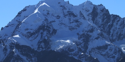
Naya Kanga Peak Climbing also known as Ganja-La Chuli, is magnificently situated in the Langtang region in Nepal. Langtang is one of the popular trekking destination in Nepal situated north from Kathmandu is easily accessible by road transportation to Duncheor Syabrubesi. Langtang National park was designated as the first Himalayan National park in 1970. The area extends from 32 KM north of Kathmandu. The highest peak in the area is Langtang Lirung (7200m) in the whole region. Its accessibility makes it an ideal choice of short visit to the Himalayas, allowing the climbers to experience some best mountaineering activities all in short period within 2 weeks. Amazing Nepal Journey always organizing only Langatng Trekking too for Tibetan pure culture still exiting here. The normal route to climb Naya Kanga Peak is via the snowy north-east ridge. The trip starts with driving from Kathmandu to the north and arrives at small town of Syabrubesi. Then we walk through the dense forests of Bamboo, Oaks and pines following the narrow valley along Langtang Khola to the north-east. Once we get to Goratabela (2900m), the Langtang valley get wider and one can see Massive Langtang range rising above the skyline. Then heading up to Langtang village which is the biggest settlement of the area influenced by the pure Tibetan culture. Once we reach the Kyangjin Gompa; the last settlement where is many lodges are run all year round. From there we make day hike up to Kyangjin Ri (4700m) or Tsherko Ri (4980m) for the spectacular Himalayan views of the area and acclimatization. Then we cross the Langtang Khola south of Kyangjin Gompa and trek to Naya Kanga Base camp. We set up high camp and start the climbing from there. From the summit it can view the spectacular scenery of the mountains such as Langtang Lirung, Dorje Lhakpa, Gang Chhenpo, Ganesh himal ranges, Manaslu Ranges to Annapurna ranges, mighty Sishapangma (8013m) in Tibet as well the great views of the valley on the south including Kathmandu. We will be trek same route back to Syabrubesi and drive to Kathmandu.
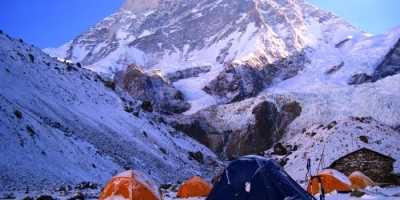
Mt. Makalu is the fourth tallest mountain in Nepal and fifth highest Peak in the world with its height 8,463m. Mt. Makalu resides in the eastern Himalayas range just 19Km southeast of the giant Mt. Everest in the border of Nepal and China The Makalu based on the Barun Valley, diverse species of flora and fauna with rich cultures of ethnic communities like Sherpa and Kirat. Although, this area is so beautiful Landscape, every trekkers who every step here will take a memorable reminiscence with them for their lifetime. Along the way really interesting agricultural land. It was in 1955, when the expedition led by French team reached to the top of Mt. Makalu for the first time. Sir Edmund Hilary took the photograph of Mt. Makalu in 1951 while he was on a route survey of Mt. Everest. Since the first climb to the top, several successful attempts had been made to the top of the peak. Makalu bears a pyramid shape. South East and the North West Ridges being the most prominent compared to other. Among these two, the North Western ridge route is used by most of the mountaineers to reach the top of the peak. Mt. Makalu Expedition in Nepal is full of adventures as well as dangers too. The Russian team scaled the west route, which is considered the most dangerous route, in 1997. They reach the top on 21st May 1997 following the most challenging route. It's very technical climbing snow mountain and quite challengeable route.The base camp is generally set up around 5,600m. The first camp is at 6,100m, camp 2 is at 6600m, the third camp is at 7200m and the last camp is at 7600m.
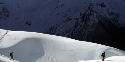
Lobuche East Peak Climbing is an attractive summit, offering a variety of existing routes and wide scope for new lines. Lobuche east (6119 m) and Lobuche west (6145 m). Although they are connected by a continuous ridge there is a sharp gap and a considerable distance between them. Lobuche Peak climbing is an attractive summit with existing routes and new opportunities. Lobuje east peak is moderate of the trekking peaks that commercial groups attempt. The true summit of Lobuche East proved an elusive goal. A Swiss first climbed the rocky outliners, but the subsequent attempt fell short of the actual Summit, soaring above a profound notch at the far end of west/south — East Ridge, was finally climbed in 1984. The East face, accessible from Lobuche, has attracted different teams. Jeff Lowe has added a difficult route up an icy collar, while Todd Bible and Catherine Freer climbed the rocky East Ridge. Labuche Peak expedition starts from Lukla the ‘Gateway for trek and climbs in the Everest area’. The major attractions on our way to the base camp are the famous Sherpa town called Namche Bazaar, the Tengboche monastery (the cultural / religious center for the Sherpa people of Everest region), Pangboche (oldest and permanently settled highest amongst all Sherpa villages), Dingboche (probably highest place in the world for barley cultivation). It is our pleasure to trek up to Kalapathar before commencing the climb for a close view of Mt. Everest. Our base camp is established at the periphery of a hidden lake in a rocky hollow at the base of the glaciated South West Face near Point 5,551m. No doubt, the spectacular views of Amadablam and Tawache are clearly viewed from here. We gain our climb steep terrain leading beneath the main glacier on the South West Face of Lobuche and attain access to the South Ridge. We establish our camp higher on the ridge. We continue further on the South Ridge and then follow the summit ridge; north-west from the high camp. We have a great view of Mt. Everest, Makalu, Lhotse, EBC, Pumori , Baruntse, Mera, Island peak , Ama Dablam, Thamserku etc Himalayan panorama that include all important peaks in the Khumbu Valley from the summit. Gradually, we descend from the summit to the High to the Highamp and same day Thukla overnight and next day head down to Lukla to catch our flight to Kathmandu. Amazing Nepal Journey Treks & Expedition is organizing such beautiful adventure trip in Nepal since two decades up to now with 100% achievement with fully satisfaction of the all clients.
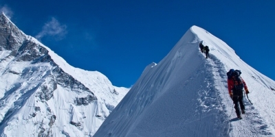
Island Peak is a great first Himalayan Peak in the region of Everest. The route to the summit includes a steep slope and a narrow ridge. Full set of climbing gears are necessary for 100% safety , and it is useful to have guide who knows the best part of the ridge to climb. The term "trekking peak" 33 mountains given this title by Nepal Mountaineering Association in Himalaya, Island Peak Climbing is a spectacular extension to a fabulous adventure into the Everest region. At 6160 meters, Island Peak is also known as Imja Tse . No technical mountaineering experience is necessary to climb Island Peak, simply a high level of fitness the desire to push your limits. Island peak summit is interesting and attractive with a highly glaciated west face rising from the Lhotse Glacier. The mountain itself is the extension of the South Ridge of Lhotse Shar separated by a small Col. The ridge rising to the south from this point leads to the summit of Island Peak. The extension of this ridge descending south-west is the part of the normal route of ascent and leads to the South Summit. Imja Tse not only provides an enjoyable climb but also provides some of the different spectacular scenery of Himalayas in the Khumbu Region including the Mt. Everest 8848m, Mt. Nuptse 7,855m, Lhotse 8,516m, Lhotse Middle Peak 8,410m and Lhotse Shar 8,383m make a semicircle in the north. The views of Makalu 8,475m in the east, Baruntse 7,720m, and Mt. Amadablam 6,856m in the south add more charm for climbing Island Peak. The normal route for Island Peak Climbing is South East Flank & South-West Ridge normally; the Island Peak base camp is set at 5,087m between Imja Tse and the lateral moraine of the Imja Glacier. Embark on a wonderful adventure with Island Peak climbing and trekking that takes you into the heartland of the Khumbu and Everest Base Camp 5,357m. Island Peak 6,160m is one of the main climbing peaks in Everest Region with an impressive and highly glaciated West Face that rises from the Lhotse Glacier.. The magnificent views from the summit, however, are certainly a fitting reward for your efforts. Before climbing Island Peak, we trek up the Dudh Kosi valley from Lukla, passing through Namche and Tengboche on our way to Kala Pattar and Everest Base Camp. After being rested and feeling physically fit and acclimatized, we then head up the beautiful Imja Khola valley towards Island Peak. Besides trekking adventure, we also get to witness pristine Sherpa villages and ever-so-serene monasteries. With ponderous memories of the trekking earlier done, we retrace our route back through Namche to Lukla, and from there on we fly back to Kathmandu or new destination. Amazing Nepal Journey Treks & Expedition is organizing such beautiful adventure trip in Nepal since two decades up to now with 100% achievement with fully satisfaction of the all clients.
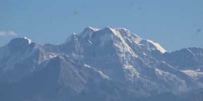
Mera Peak (6,654 m) is the highest permitted trekking peak of Nepal. It stands to the south of Everest and dominates the watershed between the heavily wooded valleys of the Hinku. J.O.M. Roberts and Sen Tenzing made the first successful ascent of Mera Peak on 20 May 1953. The route they used is still the standard route. There are many other routes to the peak, but none of them are easy. Some of them require crossing very high and difficult passes. This leads to a true mountaineering experience. In the end, all efforts and hard work is paid off with spectacular scenery as Mera provides one of the finest view points in Nepal. Mera Peak offers a panoramic view of Chamlang, Kangchenjunga, Makalu, and Baruntse in the east and the peaks of Cho-Oyu, AmaDablam and Kangtega to the west. Everest can be viewed to the north over the massive unclimbed south face of Lhotse and the Nuptse/Lhotse ridge. Under favorable conditions, it is possible to climb the peak and descend back on the same day to Khare.Well, Mera peak is easy climbing but not really due to long walking on the snow and ice some occasion, its offer the best view same time big wind play vital role for cold and extra tiredness for climber. In generally, technically point of view approximately 15 meter near the top is technical rest of totally waking in the case of Mera center but for south is not so. On the way to high camp and summit pay attention with crevasse. So you should have a good experience guide for safe the trip. Think once time with very clearly never compromise for a good guide, life is important and safety is first forever and never go .“ We always offer our best for our clients” its our principle.Since 1998, Amazing Nepal Journey Treks & Expedition organizing highly successful and save full climbing to Mera peak so all customers are getting great achievement and happiness.
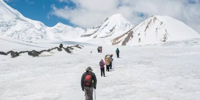
Upper Mustang trek, which offers a spectacular trekking into the remote Trans-Himalayan mountain area with Tibetan influence culture. The high desert region of the Tibetan influence, Kaligandaki, from the Tibetan border south to Kagbeni is generally referred to as Upper Mustang. Explore the thousand years of old monastery, caves, local tribes and scenic beauties of the different landscapes. Make an adventure starting from world's deepest gorge Kaligandaki Region into world's highest regions of Lo-Mangthang Valley that passes through an almost tree-less barren landscape, a steep rocky trail up and down hill and panoramic views of Nilgiri, Annapurna, Dhaulagiri and several other peaks. The trek passes through high peaks, passes, glaciers, and alpine valleys. The thousands years of isolation has kept the culture, lifestyle and heritage remain unchanged for centuries and to this date. The houses in Mustang are mostly made from stone and sun baked mud bricks. The city wall and the four storey palace in Lo-Manthang are some of the beautiful architectures of Mustang region. Another attraction in the Mustang region is the Tiji Festival influenced by Tibetan Buddhism, which is timed to coincide with the end of the dry season (late winter/spring). The Mustagi people have their own way of family life, which is quite surprising for many outsiders. All the brothers in the family are married to a single girl, what you may call a practice of polyandry.The Transhimalayan Mustang Region is also known as the Last Forbidden Kingdom, since the region was restricted for outsiders until Nepal Government announced the opening of the restricted areas in October 1991. The Mustangis or the people of Mustang call themselves Lobas, and they have their ownKing or Tribe-leader, JigmePalbarBista. After Nepal was declared a republic in 2007, the Nepal Government took back the official recognition of the Bista as the Mustangi King. However, the people there still respect him as their King or tribe-leader. Bista also grants audience the visitor upon request. There is also strict control in obtaining a special permit from the department of immigration to protect their tradition from outside influence as well as to protect their environment. The Upper Mustang trek starts from Jomsom to Kagbeni, the entry point of upper Mustang Region. Follow the banks of Kaligandaki River upstream to get to Lo-Mangthang, the capital of the upper Mustang.The trek through the Nar & Phu valleys combines high peaks and passes, glaciers, remote villages, narrow canyons, lovely forests, amazing rock formations, yaks, gompas and unique ethnically Tibetan cultures. Closed to trekkers until late 2002, very few outsiders have explored these virtually untouched villages or climbed the many 7000 meter peaks surrounding them.Starting at Besisahar/ Mustang — the traditional starting point of the Annapurna Circuit — the trek quickly diverges from routes with more foot-traffic and into the remote Nar & Phu valleys. Passing colourful Tibetan chortens and prayer stones into deep canyons and gorges, you will get the chance to hang out with villagers in Phu while they go about their daily activities, as well as spend a night in the Nar Phedi monastery. These are ideal ways to learn about life deep in the mountains of Nepal.
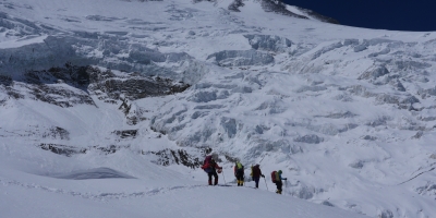
Mt. Dhaulagiri is the sixth highest peaks in Nepal and the seventh highest peak of the world with its height 8,167m above from the sea level. This mountain lies in the northwestern of Nepal. “Dhaulagiri” is derived from the Sanskrit word, “Dhawala and Giri” which means “White and Mountain” or White snow mountain. Mt. The Annapurna I, which is 34Km east of Dhaulagiri I, in between these two giants a gorge is formed, known as Kaligandaki Gorge, This gorge is deepest gorge in the world and Kaligandaki River flows in this gorge. One of the best mountain for high skill climber in the world.Dhaulagiri is reflected as one of the most fascinating peaks to climb. Mt. Dhaulagiri has 5 ridges and south and west faces, Majority of the scaling have been following the first route, which is known as “Normal Route”. Northeast route is considered as the normal route; However, Mt. Dhaulagiri has been scaled from every direction. It was the team of Swiss /Austrian Mountaineers led by Kurt Diemberger who first reached to the top of Mt. Dhaulagiri on 13th May 1960. As all of Dhaulagiri routes are challenging, only veterans seems to have interest in this mountain. The carvan route is from Kathmandu - Beni- Darbang- Sallaghari - Italina Camp- finally rreach to the reall Bascamp fo Dhaulagiri.Alternative trekking route , Kathmandu -Pokhara- Marapha- Hiden Valley.The base camp is normally set at around 4,750m, and then three camps follow before reaching the top. The first camp is at 5,850m, camp 2 is at 6400m, and the last camp is at 7400m.

Ama Dablam Expedition is one of the most spectacular mountain climbing adventures in Nepal. The isolated Mt. Ama Dablam (6812m/22349ft.) is one of the most impressive mountains in the world. Located just to the south of Everest in Khumbu valley, it is distinguished by its vertical walls to the south and north as well as the sharp exposed ridges from all directions. Ama is considered the Motherhood of the Himalaya. Ama Dablam means "Mother's necklace" the long ridges on each side is like the arms of a mother carrying her child. The hanging glacier is thought of as the Dablam, which traditionally is worn by Sherpa woman as a double-pendant containing pictures of the Gods. A pearl of beauty in itself that commands its surroundings and captures your attention by its presence outstanding image of ice wall. This expedition is a serious undertaking and is a strong prerequisite to Everest. In terms of technicality Ama Dablam is considered harder than Everest. It demands a high skill level in rock climbing and ice climbing; sufficient experience at high elevation and technical competency. Ama Dablams summit is located at 27°51'42'' N longitude and 86°51'40'' E latitude. The climbing legend of Ama Dablam was first climbed on 13 March 1961 by Mike Gill (NZ), Barry Bishop (USA), Mike Ward (UK) and Wally Romanes (NZ) via the Southwest Ridge. They were well-acclimatized to altitude, having wintered over at 5800 meters near the base of the peak as part of the Silver Hut Scientific Expedition of 1960-61, led by Sir Edmund Hillary.Ama Dablam is the third most popular Himalayan peak for permitted expeditions in Nepal. The most popular route by far is the original first ascend route along the Southwest Ridge. The climb is typically done with three camps along the ridge with camp 3 just below and to the right of the hanging glacier (mushroom ridge ). A climbing permit and a liaison officer are required when attempting Ama Dablam. You need to have a strong base of rock and ice climbing experience to climb this mountain. Most of the route on Ama Dablam is fixed, so climbers will need to be competent at ascending and descending fixed ropes and passing via anchors. There is one pitch on the route that is just about dead vertical, so practice ascending a vertical fixed rope before the expedition. Climbing season is April- May and September - December to Ama Dablam.The standard climbing route is via the Southwest ridge with typical arrangements of 3 high camps: Camp 1 (5600m), Camp 2 (5900m) and Camp 3 (6200m) with Base Camp at 4500m. Camp 3 is located on the shoulder of the ridge just below and to the left of the last steep snow climb to the summit.. Most climbers summit from camp 2(yellow tower and do not establish a camp 3, who are very strong climber and on the tope around 100m space remain. Amazing Nepal Journey always dedicating such a great adventure expedition in Himalayn world.
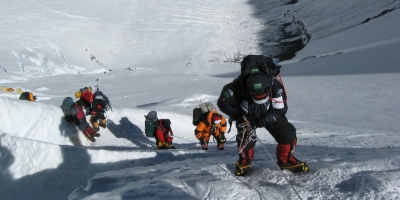
Mt. Everest is ultimate destination for Mountaineers with full of Adventures. Mt. Everest, known as the Sagarmatha in Nepali and also called Chhomolungma in Tibetan Language is with an altitude of 8848m. The southern face lies in Nepal whereas the northern face is in Tibet. Peak XV was renamed after Sir George Everest as Mount Everest, name given in his honour, who was lead surveyor in 1856. Sir George was Welsh Surveyor, he was surveyor general of India for thirteen years from 1830. The Everest has fascinated the mountaineers all around the globe since 1920s when Tibet opened the climbing in early 1920s. In 1922 British Expedition team led by Charles Bruce tried to scale the summit of Mount Everest for the first time. It was Edward Norton in his second attempt along with British Expedition team set the height of 8572m. The mountaineers George Mallory and Andrew Irvine disappeared on the third attempt. Mallory's body was found in 1999. There were several attempts made to Everest before the successful attempt made by Edmund Hillary and Tenzing Norgay on 29 May 1953 via the South route. It is now reported that around 1000 ascent attempts are made every year. On Everest different route for climbing such as North Site and South Site. There are will take the southern route to the summit. This trip suits for those who has previous experiences of few 7000m peaks or even more. The real trek apparently starts from the Base Camp and to reach the base camp takes you around 7 days on foot from Lukla, if follow the classical route but different trail reach to EBCCamp 1 (6,065m) where we will see Khumbu glacier. From Khumbu Glacier, it around 450m on a gradual slope to Camp II (6,750m) and around 610m to Camp III (7,100m). Camp III is located at the head of Lhotse. From this point onwards, you will be needing oxygen cylinders. You will reach the Camp IV (7,910m) after just crossing 8000m elevations. This point is also known as the Death Zone.Mount Everest Expedition is undoubtedly a lifetime opportunity. Nevertheless, these expeditions encounter many hindrances such as high altitude, severe weather conditions and avalanches. One must be well trained before actually trying it. You need to get your body ready for the 8848m foot climb to Everest's summit. Depending on your current level of fitness, you need to train for several months before you start your ascent. A climber must build his/her cardiovascular strength along with muscular strength, oxygen level drops by 60-70 percent from sea level. Also make sure you can carry big bag packs to top as you will be carrying cylinder of oxygen and large bag packs along with you. One must acclimatize with weather conditions and be prepared for rock falls, avalanches. Learning rescue techniques would be an added advantage
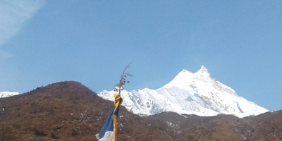
Mt. Manaslu Expedition is eighth highest peak of the world which is elevated at the height of 8,163m (26,781 ft) above the sea level is located in the ridges of Mansiri Himal in Nepal. Regarded as the “mountain of spirit”, Mt. Manaslu is identified as Mt. Kutung in Tibet. This peak lies about 64km east of Mount Annapurna.Japanese team north face expedition climbed Mount Mannaslu (8163m) was first climbed in 1953. The meaning of this mountain is derived from Sanskrit language meaning ‘Intellect’ or ‘Soul’ similar to the meaning of the holy Lake Mansarovar near Mount Kailash in Tibet. Just as the British considered Everest their mountain, Japanese regard Manaslu as ‘Japanese Mountain’ because Japanese people were the first to conquer its top. In 1950, HW Tillman and Jimmy Roberts photographed Manaslu during a trek but the first real survey of the peak was made by a Japanese expedition in 1952.The ascending is technical than that of other peaks like Cho Oyu and Shisha Pangma. Base camp of Manaslu lies at a height of 4700m. Long crests of mountain offer possibility to be scaled from every direction to conclude to the top that is sharply above its neighboring scenes. Among six routes, route starting from south is hard hitting while the northeast face route being the most common.Spring season is good climbing to Mt. Manasalu even though Autumn is the best climbing time for Mt. Manaslu. After the rainy and summer season, the temperature starts decreasing. Snow in the mountain area starts depositing. The weather is warm and not too cold. The high mountain rocky peaks start getting thicker snows. Due to the starting of snow deposit rope fixing is easier. The temperate of Mt. Manaslu in the day time will be found mild for climbing. As per our experience climbing in autumn is easier and the success rate of summit is high in the autumn. The routes are lush green, walking areas are flourish with many natural flowers. Due to the gradually decreasing of temperate, the snow depositing in the mountain just starts. In the begging the routes are clearly visible and no kharpases are filling lightly with snow. Fixing the climbing ropes, ladders and camps are more easily in autumn. Amazing Nepal Journey Treks & Expedition organizing Manasalu Successful expedition forever.

Himlung Himal (7,126m/23,345ft) is a 7000m peak that is located in the western region of Nepal.Situated just above of Budhist Phu Village .Himlung lies in the Naar-Phu region in the northeast of Annapurna and northwest of Manaslu Himalaya. Naar-Phu region was officially opened in 1992 for foreign expeditions and trekkers. This region is still a restricted area, for this reason all climbers are required to get a special restricted permit and climbing permit, and Annapurna Conservation Permit to enter the valley. The peak gained more popularity when Mr. Akio Koizumi from Japan reached the summit of Himlung Himal on 3 October 1992. This region sees fewer expeditions than any other mountains in other regions such as the Khumbu. In terms of popularity, the climbing in Naar-Phu is not comparable with the Khumbu. The valley rivals in beauty to the more popular Khumbu, offering magnificent views of Manaslu, Annapurna, Fishtail and Gangapurna. The second ascent of the peak was made ten years after the first ascent by a French expedition team in 2002. According to the summiteers experience this 7000m peak is one of the safest and largely uncomplicated projects in the Himalaya. The ascent of Himlung Himal via the normal route poses no technical problems. The route leads through snow and ice without any rock climbing passages. The climbing season is in the September, October and spring.During the Himlung Himal expedition Amazing Nepal Journey will always focus on our client’s success, ensuring safety, comfort and an enjoyable experience. Our strategy has been designed by an exercise physiologist and experienced climbing Sherpa guides who have high altitude training. We try our best to be as efficient as possible with our itineraries, ensuring that there is not a lot of wasted time. We consider the fact that our clients might have only a short time off of work, rest assured that your time and money will be well spent with Amazing Nepal Journey treks & Expedition . This 7000m peak is technically moderate and a good preparation for upcoming expeditions like Manaslu, Cho-Oyu, Everest etc.The walk-in along Phu River is a unique experience even for Nepal, the pristine beauty is really a sight to see. Being that the villages in this valley are so close to Tibet they are heavily influenced by Tibetan culture. The journey begins with a scenic drive continue 6 hours to reach Koto (2600m/8,530ft) from Beshishar by local jeep.You will have one acclimatization day at this historical village. Feel free to explore this village or rest. From Koto it is a 5 days trek to the Himlung Himal base camp (4850m/15,912ft).The trail turns toward the East and passes through Dharmasala, Meta, Kyang and Phugaon, which is the largest ancient Buddhist settlement in the region. The base camp is in a subalpine zone with alpine grass and other greenery; it is very comfortable and accommodating. There are approximately 5-7 climbing teams each spring and autumn season. Expedition staffs of the Amazing Nepal Journey Treks ad & Expedition are well prepared Base Camp set for successful summit to Himlung Himal.
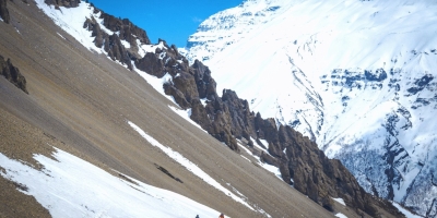
Mt. Tilicho Peak is towers at the height of 7,134m. Mountaineers rate this as a technical climb, and not so easy. There are two ways to reach up to Base Camp. Tilicho Peak expedition starts up with a drive Khudi followed by several days trekking to the Tilicho Base Camp via Manang and Khansar Village as well as another way is a short mountain flight from Pokhara brought us to the dry and dusty hill town of Jomsom as well as start from Beni Bazaar to Jomsom OR FLIGHT to jomsom from pokara. From here we proceed east and north to cross the high and very difficult Mesokanto Pass at an altitude of 5300m. At the top of the pass we managed to locate some marine fossils (shells) which testify to the fact that the Himalayas was once beneath the sea. We choose the first idea as this allows enough time for acclimatization and less difficulties for taking all the logistics. The views on the routes are breath taking; anything that can surpass your imagination. What you see is Tilicho Peak and the azure and peaceful Tilicho Lake below. It is a glacial lake and unfriendly to marine life. People say they often find marine fossils (shells) that probably support the fact that the Himalayas were once beneath the sea.We set up the base camp near the lake some of days will be rest celebrating the Puja by ourselves. Tilicho stands as a daunting task above the camp which is on a moraine. From the base camp (around 4400m.) we set out for our final goal – Tilicho 7,134m. Tilicho (7,135m) as seen from near the Base Camp.Base Camp to Camp (i) - Climbing route is straight steep 70º/90ºCamp (i) to Camp (ii) - Climbing route is strait steep 90º with ice vertical.Camp (ii) to Camp (iii) - Climbing route is steep to get summit 40º/60º or Max. 70º

Island Peak(6165m)Island Peak , or Imja Tse, is the most popular trekking peak in Nepal. It lies in the Mahalangur Himal range in the Khumbu region. From Dingboche, the mountain appears as an island rising from the depths of the surrounding icy desert, hence its name, Inselberg, coined by Eric Shipton. It was renamed Imja Tse in 1983, but is still commonly referred to as Island Peak.The first ascent was made in 1956 by a Swiss mountaineering team as training for their ascents of Mount Everest and Lhotse. The mountain's southwestern subsidiary peak was first reached in 1953 by Charles Evans, Alf Gregory, Charles Wylie, and Tenzing Norgay.The summit is interesting and attractive, with a heavily glaciated west face rising from the Lhotse Glacier. The mountain itself is an extension of the south ridge of Lhotse Shar and is separated from it only by a small col. The ridge ascends southward from this col and leads to the summit of Island Peak. The continuation of this southwest-descending ridge is part of the normal ascent route and leads to the south summit.Imja Tse offers not only a pleasant climb but also some of the most spectacular landscapes in the Himalayas, particularly in the Khumbu region. From its summit, you can see the towering peaks of Lhotse (8,501 m), Nuptse (7,879 m), Lhotse Middle Peak (8,410 m), and Lhotse Shar (8,383 m), which form a semicircle to the north. The views of Makalu (8,475 m) to the east, and Ama Dablam (6,812 m) and Baruntse (7,129 m) to the south will remain etched in your memory forever. Southeast flank and southwest ridge: Island Peak Base Camp is located on Paresho Gyab at 5080 m, between Imja Tse and the lateral moraine of the Imja Glacier. It should be noted that the site may be exposed to avalanches in the event of heavy snowfall. From base camp, a well-acclimated trekker can, under good conditions, make the summit ascent and return to base camp in a single day. However, most climbers prefer a high camp, Attack Camp, at 5600 m, which facilitates a safer ascent. From base camp, the route leads southeast to the base of Imja Tse and then ascends steep, grassy slopes and small rocky steps. You climb an open gully that leads between two ridges to the high camp on the ridge below to the left. To the right is a small hanging glacier (5280 m). From high camp, you climb the left ridge via a wide, open gully. After crossing the ridge, a steep, approximately 100-meter-long snow and ice ramp leads up to the summit. The ascent near the summit is somewhat more difficult due to the steepness.North Ridge: North of the main summit, the ridge continues to a col at 5700 m. The route first ascends the ridge crest, then reaches the right bank of the Imja Glacier and later the moraines on the right bank of the Lhotse Sar Glacier. From there, it continues northwest over snow-covered slopes to this col. A high camp is established at the col during the initial ascent. From the col, the scenic snow ridge is followed southwards, leading up to the summit pyramid. It is a long ridge that can be difficult to traverse in soft snow conditions. The final ascent to the summit is slightly more challenging than the standard route. Lobuche East(6119m):Lobuche East is a popular climbing peak destination and is still considered a trekking peak in Nepal (a climbing peak of category "B"), although the summit includes steep ice and snow sections in its final section. Most climbers do not ascend the actual east summit, but rather the so-called "false summit" to the south. Its difficulty is comparable to Island Peak, and a permit is required for the ascent. The base camp is located on the southwest flank at an altitude of 4950 m.Lobuche East Peak is an attractive summit offering a variety of ascent routes, some already climbed and others still possible. Viewed from close up at Pheriche, the dark triangle of its rocky east face rises above the moraines of the Khumbu Glacier to an icy silhouette. This view reveals the south ridge, where the east face intersects with the glaciated ascent route. This route continues northwest from the top of the east face, over several small peaks, to the summit ridge leading to the East Peak. Lobuche East Peak presents no climbing difficulties; however, the summit area contains steep sections of ice and snow, requiring scrambling along the ridge and crossing some crevasses.The first recorded ascent of Lobuche East was made by Laurence Nielson and Sherpa Ang Gyalzen on April 25, 1984. Since then, there have been numerous ascents of the summit by climbers from all over the world. After descending into a distinct notch and ascending steep snow and ice fields, you reach the prominent true East Summit. This actual summit is rarely climbed and is often mistakenly considered Lobuche West. Most climbers only ascend the summit ridge as far as the lower snow peak before the depression, the "false" East Summit, located southeast of the true summit.

Feel free to inquire, and together, we'll design the perfect journey to suit your preferences and desires.


 (18)
(18)  100% recommend (0)
 (0)
(0)